Overview
This exercise is intended to contrast how to build a DoD (DEM of Difference) with simple change detection minimum level of detection thresholding in ArcGIS’s raster calculator versus using the GCD.

Sulphur Creek, CA
- 300m of gravel bed river near St. Helena California that underwent a flood in December 2005.
- Two surveys
- 0.5m cell resolution
- RTKGPS and Total Station
River Feshie, Scotland, UK
- 700m braided gravel bed river in the Scottish Cairngorm mountains.
- 5 annual surveys
- Mix of RTKGPS and Total Station
- 1m cell resolution
Prerequisite for this Exercise
- Some ArcGIS experience
- ArcGIS 10.X w/ Spatial Analyst Extension
- GCD Add-In
Step by Step
Part 1A Raster Calculator
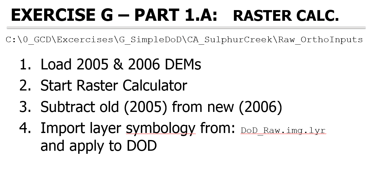
In this video tutorial, we show you how to do a simple DoD Analysis in ArcGIS 10 just using the rater calculator.
The example data used in this tutorial are from Sulphur Creek, Napa County, California.
For corresponding lecture slides and more context, see this topic from GCD Workshop.
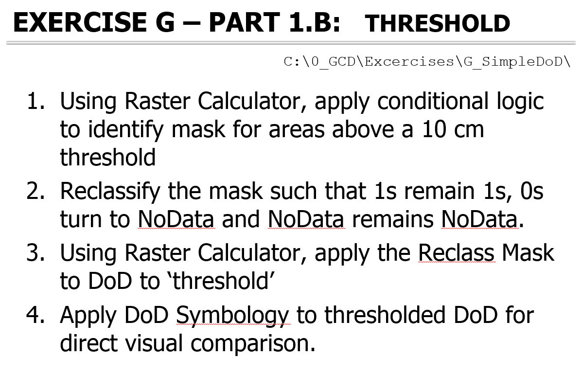
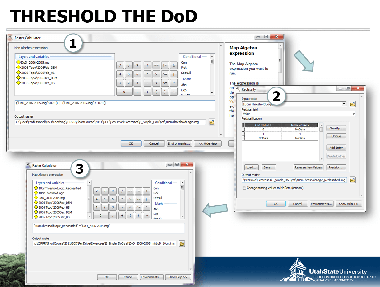
Part 1B Threshold
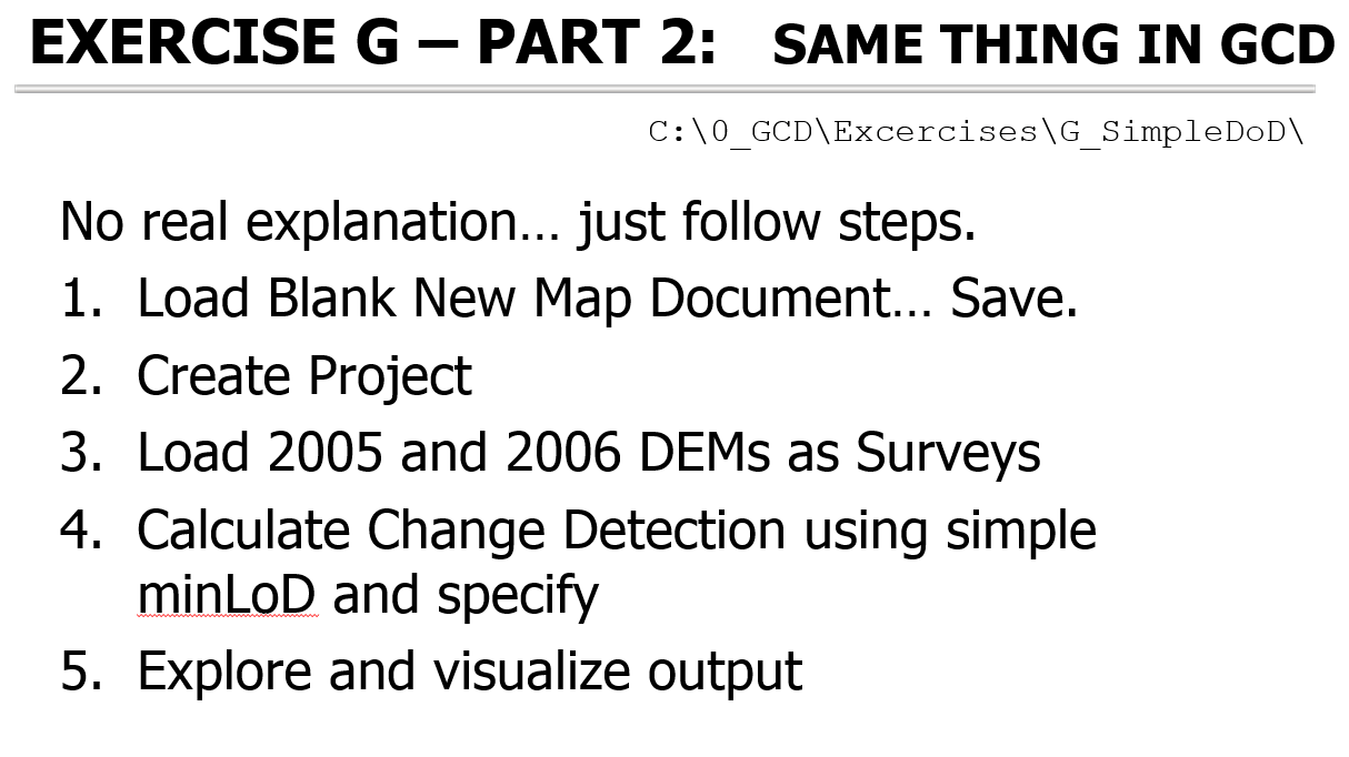
Part 2 GCD
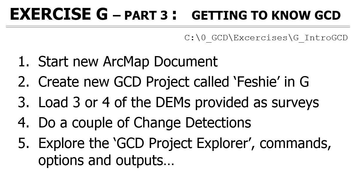
Part 3 Practice in GCD
GCD 7 Tutorial Video
GCD 6 Tutorial Video
Related Online Help or Tutorials for this Topic
-
GCD Tutorial Topics:
- Building DEMs Lab - From my Advanced GIS course